THE National Disaster Risk Reduction and Management Council (NDRRMC) has raised its alert status from “blue” to “red” to provide immediate emergency response as Nando intensified into a typhoon over the Philippine Sea.
In an advisory released on Saturday, the NDRRMC said it issued Memorandum 245, categorizing the emergency condition under “red alert.”
A red alert is the highest status of the National Disaster Risk Reduction and Management Operations Center (NDRRMOC), activated to address an ongoing or imminent emergency. It ensures full staffing of response agencies and immediate interagency coordination.
The red alert provides full response agency staffing at the NDRRMOC and allows immediate interagency coordination.
Under this status, detailed duty officers from the Armed Forces of the Philippines, Bureau of Fire Protection, Philippine Coast Guard and Philippine National Police, as well as technical staff of relevant agencies, including the Department of Health, are required to render duty at the NDRRMOC.
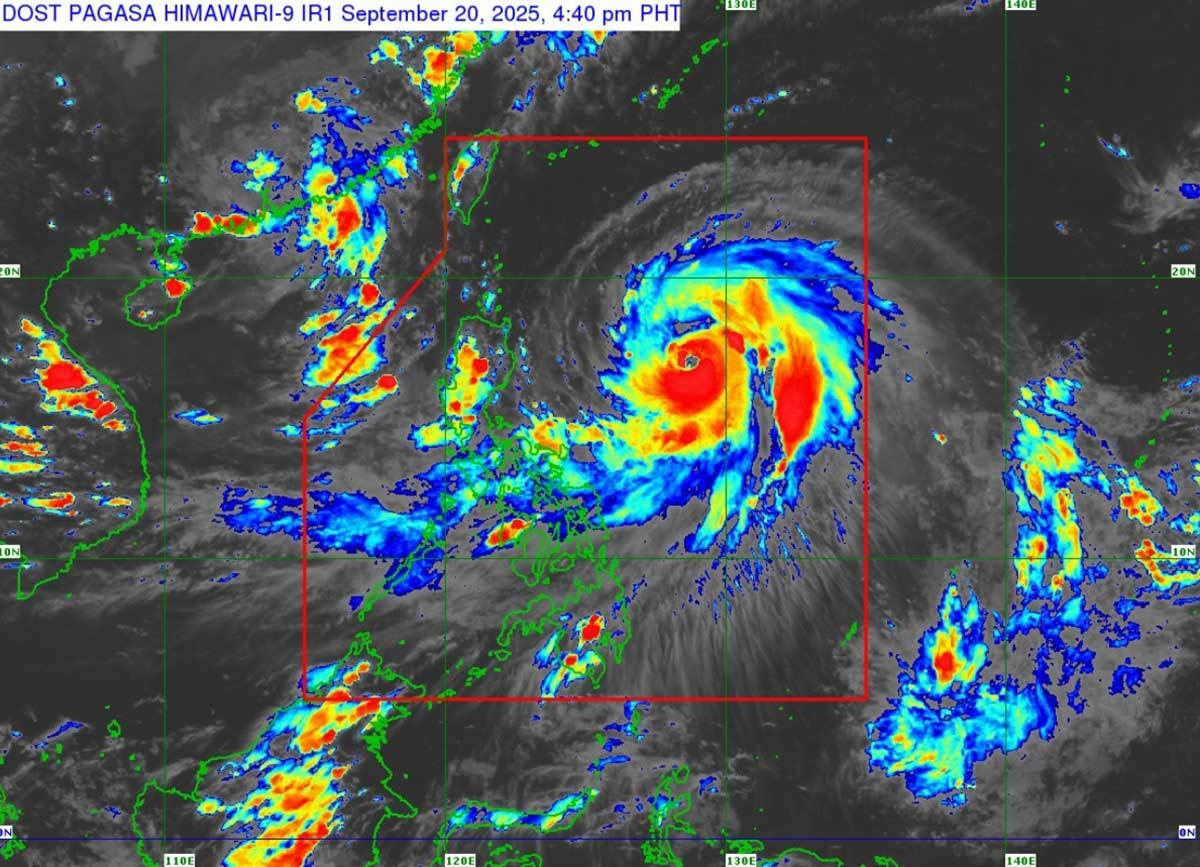
In its 5 p.m. update on Saturday, the Philippine Atmospheric, Geophysical and Astronomical Services Administration (Pagasa) said that Nando’s center was estimated based on all available data at 770 kilometers east of Echague, Isabela.
On the forecast track, the center of Nando may pass close to or make landfall over Batanes or the Babuyan Islands on Monday afternoon or evening, and exit the Philippine area of responsibility by Tuesday morning.
It has maximum sustained winds of 140 km per hour (kph) near the center, gustiness of up to 170 kph and central pressure of 970 hectopascals.
At the time of the update, it was moving northwestward at 10 kph.
As of 5 p.m. on Saturday, the following were placed under Signal No. 1: Batanes, Cagayan, including Babuyan Islands, Isabela, Quirino, the northeastern portion of Nueva Vizcaya (Kasibu, Quezon, Diadi, Bagabag, Villaverde, Solano, Ambaguio, Bayombong, Bambang, Dupax del Norte), Apayao, Kalinga, Abra, Mountain Province, Ifugao, Ilocos Norte, the northern portion of Ilocos Sur (Sinait, Cabugao, San Juan, Magsingal, San Vicente, San Ildefonso, Santo Domingo, Bantay, Santa Catalina, City of Vigan, Santa, Caoayan), the northern and central portions of Aurora (Dilasag, Casiguran, Dinalungan, Dipaculao, Baler), and the northern and central portions of Catanduanes (Pandan, Caramoran, Bagamanoc, Panganiban, Viga, Gigmoto, San Miguel and Baras).
Pagasa added that the southwest monsoon and the trough of Nando could bring strong to gale-force gusts over Metro Manila, Central Luzon, Calabarzon, Bicol Region, Mimaropa, Visayas, Northern Mindanao, Caraga, Davao Occidental and Davao Oriental on Sunday.
A gale warning is in effect over the northern and eastern seaboards of Northern Luzon.
”Nando will continue to intensify while over the Philippine Sea. It may reach super typhoon status by Monday before its close approach to Batanes-Babuyan Islands,” Pagasa said.


")