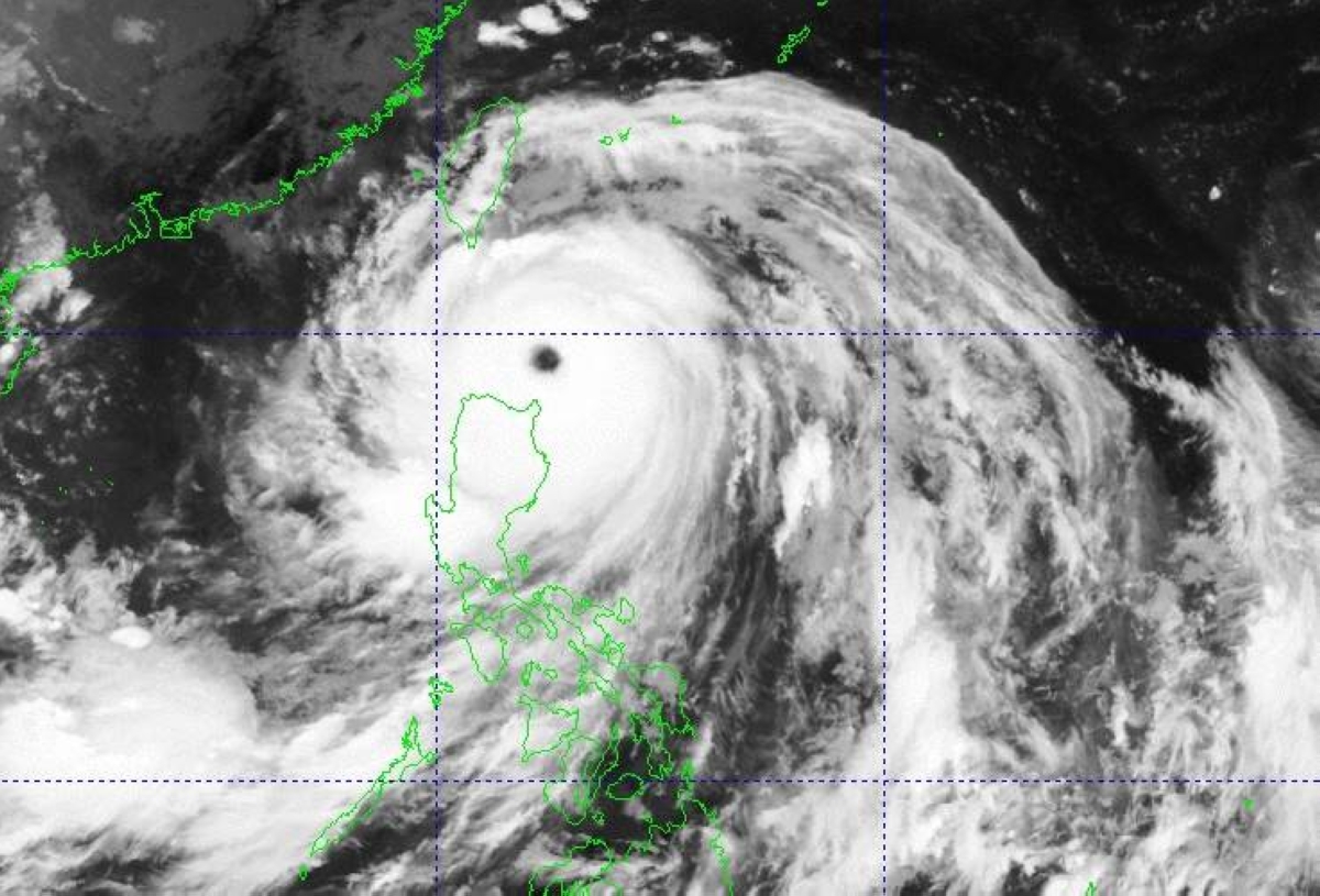
MANILA, Philippines — Super Typhoon Nando has further intensified as it begins to turn westward, threatening Babuyan Islands in extreme Northern Luzon, the weather agency said on Monday.
Nathaniel Servando, administrator of the Philippine Atmospheric, Geophysical and Astronomical Services Administration (Pagasa) said that very strong winds of more than 185 kilometers per hour (kph) may be expected in at least 12 hours.
“Nando is bringing not only destructive winds but heavy rainfall so we are issuing this warning to the affected local government units to be ready and protect their respective constituents especially in areas under Signal No. 5,” Servando said.
He said that Nando will make landfall over Babuyan Islands.
Signal No. 5 has been raised over Babuyan Island, Panuitan Island, Didicas Island and Calayan Island.
Signal No. 4 is up over the southern portion of Batanes (Basco, Mahatao, Ivana, Uyugan and Sabtang), the rest of Babuyan Islands, and the northeastern portion of Cagayan (Sta. Ana).
Meanwhile, Signal No. 3 was hoisted over the rest of Batanes, the northern and central portions of mainland Cagayan and northern and central portions of Ilocos Norte while Signal No. 2 was raised over the rest of Cagayan, Isabela, the rest of Apayao, Abra, Kalinga, Mountain Province, Ifugao, the northern portion of Benguet, the northeastern portion of Nueva Viscaya, the rest of Ilocos Norte, Ilocos Sur and the northern portion of La Union.
Pagasa said Signal No. 1 is up over Quirino, the rest of Nueva Vizcaya, the rest of Benguet, the rest of La Union, Pangasinan, Aurora, Nueva Ecija, Bulacan, Tarlac, Pampanga, Zambales and the northern portion of Quezon.
Estimated some 180 kilometers east of Calayan, Cagayan, “Nando” was moving at 20 kph with maximum sustained winds of 215 kph near the center and gustiness of up to 265 kph, it added.
Meanwhile, a low pressure area has been spotted over the northeastern part of Mindanao outside the Philippine Area of Responsibility (PAR).
“We are closely monitoring its movement as it has a chance to enter PAR and even develop into a tropical depression to be named ‘Opong,’” Chris Perez, Pagasa assistant weather services chief, said.
Perez added that Metro Manila and other adjoining provinces would not be directly affected by the super typhoon but the enhanced southwest monsoon or habagat was expected to dump 50 to 100 millimeters of rainfall especially in the afternoon or nighttime.